Hola a todos,
A continuación se muestran los niveles de agua de los embalses principales de Puerto Rico para el día de hoy. Reporte PM:
Reporte generado a las 07:00 PM
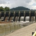
Caonillas
https://waterdata.usgs.gov/nwisweb/local/state/pr/text/pics/50026140.jpg
Nivel: 817.68 metros
Nivel de Alerta: Desborde
Hora de Lectura: 06:45 PM
# Carite
https://waterdata.usgs.gov/nwisweb/local/state/pr/text/pics/50039995.jpg
Nivel: 542.952 metros
Nivel de Alerta: Seguridad
Hora de Lectura: 06:15 PM
# Carraízo
https://waterdata.usgs.gov/nwisweb/local/state/pr/text/pics/50059000.jpg
Nivel: 40.810 metros
Nivel de Alerta: Seguridad
Hora de Lectura: 06:45 PM
# Cerrillos
https://waterdata.usgs.gov/nwisweb/local/state/pr/text/pics/50113950.jpg
Nivel: 171.374 metros
Nivel de Alerta: Seguridad
Hora de Lectura: 03:45 PM
# Cidra
https://waterdata.usgs.gov/nwisweb/local/state/pr/text/pics/50047550.jpg
Nivel: 401.736 metros
Nivel de Alerta: Seguridad
Hora de Lectura: 06:45 PM
# Fajardo
https://waterdata.usgs.gov/nwisweb/local/state/pr/text/pics/50071225.jpg
Nivel: 52.368 metros
Nivel de Alerta: Seguridad
Hora de Lectura: 06:30 PM
# Guajataca
https://waterdata.usgs.gov/nwisweb/local/state/pr/text/pics/50010800.jpg
Nivel: 625.17 metros
Nivel de Alerta: Desborde
Hora de Lectura: 06:55 PM
# La Plata
https://waterdata.usgs.gov/nwisweb/local/state/pr/text/pics/50045000.jpg
Nivel: 49.259 metros
Nivel de Alerta: Seguridad
Hora de Lectura: 06:45 PM
# Patillas
https://waterdata.usgs.gov/nwisweb/local/state/pr/text/pics/50093045.jpg
Nivel: 63.953 metros
Nivel de Alerta: Ajuste
Hora de Lectura: 06:45 PM
# Rio Blanco
https://waterdata.usgs.gov/nwisweb/local/state/pr/text/pics/50076800.jpg
Nivel: 87.85 metros
Nivel de Alerta: Desborde
Hora de Lectura: 06:30 PM
# Toa Vaca
https://waterdata.usgs.gov/nwisweb/local/state/pr/text/pics/50111210.jpg
Nivel: 154.281 metros
Nivel de Alerta: Seguridad
Hora de Lectura: 06:45 PM
Imágenes y datos recopilados del USGS (United States Geological Survey) https://usgs.gov
¡Mantente al día de las condiciones de los embalses descargando el app "Embalses de Puerto Rico" disponible para Android!
https://play.google.com/store/apps/details?id=msc.app.embalsespuertorico
Este reporte fue generado por el programa de @moisesmcardona.

Replies (0)
Conversation
No replies yet
Replies will appear here as people join the conversation.